Friends of Kings Peak
Menu

Planning Your Hike

Picture

Utah Snotel Data for Henry's Fork


 https://wcc.sc.egov.usda.gov/nwcc/site?sitenum=1193
Choose Accumulated Precipitation from the drop down menu and click the Yellow Button, most recent reading is at the bottom of the chart


Kings Peak Summit Weather  Extended Forecast


http://forecast.weather.gov/MapClick.php?lon=-110.37753&lat=40.76487#.VVv73v3nZdg


Picture
Picture

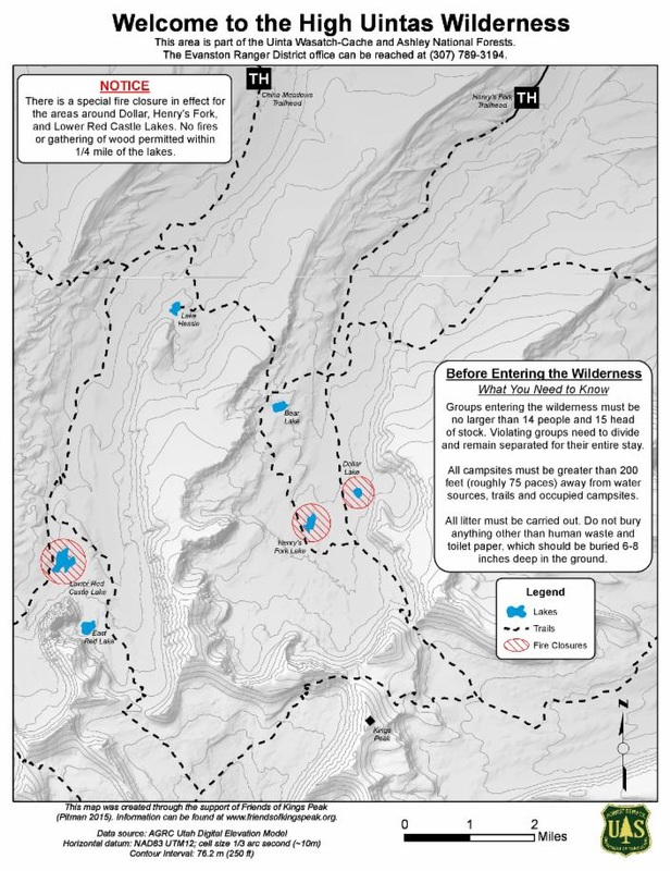
Free map of red caslte lakes and henry's fork basins

Map created by Emily Pitman in 2015 to help navigate the two most popular routes to the summit of Kings Peak. Remember to save map image to phone or print out a hard copy. There is no phone service in Henry's Fork Basin.
Powered by Create your own unique website with customizable templates.
  • Planning Your Hike
  • Road Access to High Uintas Wilderness
  • Contact Us or Donate
  • 2019 Events
  • Current Conditions
  • Planning Your Hike
  • Road Access to High Uintas Wilderness
  • Contact Us or Donate
  • 2019 Events
  • Current Conditions